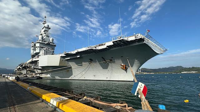
Could a simple fitness app reveal the top-secret location of a powerful military asset? Yes, it did! A shocking incident recently exposed how a French naval officer’s innocent use of the Strava exercise app inadvertently allowed journalists to pinpoint the exact location of the nuclear-powered aircraft carrier Charles de Gaulle in the Mediterranean. Despite the carrier’s deployment not being a secret, the French newspaper Le Monde successfully used public Strava data, tracing a naval officer’s morning jog on March 13, to geolocate the 42,000-ton vessel via satellite imagery. This alarming breach highlighted significant security vulnerabilities within military operations. French military spokesman Col. Guillaume Vernet confirmed that the Strava usage violated existing guidelines, prompting the navy to take “appropriate measures.” He emphasized that sailors are regularly warned about the risks associated with connected devices and geolocation features, especially given the ongoing Iran war. This security lapse is particularly concerning when considering the volatile geopolitical climate, where revealing such information almost in real-time could have severe consequences. Rear Adm. Thibault Haudos de Possesse, commander of the carrier group, had just briefed reporters about the Charles de Gaulle, which carries 20 Rafale jets and is escorted by multiple warships. Meanwhile, President Emmanuel Macron recently unveiled plans for France’s next-generation aircraft carrier, the 80,000-ton France Libre, expected to enter service in 2038. This incident serves as a stark reminder that even everyday technology can become a critical national security risk. Subscribe to our channel for more exclusive insights into global security challenges!
Follow us on social media:
– X: @BollyMirch
– Instagram: @bollymirch
📱 Tags & Keywords:
#france #aircraftcarrier #charlesdegaulle #strava #geolocation #militarysecurity #navalofficer #iranwar #lemonde #nationalsecurity