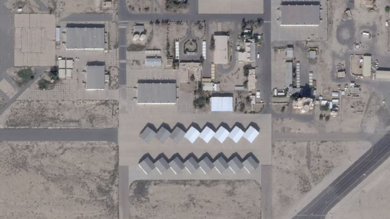
Did you know commercial satellites can literally reshape the battlefield? In a dramatic move, California-based Planet Labs has significantly extended its delay on releasing high-resolution imagery of the Middle East, pushing it to 14 days from a mere four. This unprecedented restriction aims to prevent US adversaries, potentially including Iran, from using real-time satellite photos to plan attacks against American and allied forces. This highlights a terrifying new reality where readily available commercial space data, once the exclusive domain of advanced militaries, could empower hostile actors with an “all-seeing eye.” Militaries increasingly rely on space for critical operations, from target identification to guiding weapons, making the commercial sector’s influence a profound game-changer. Experts warn that the widespread availability of such imagery, now bolstered by AI for rapid analysis, makes concealing military forces and deception operations incredibly difficult. This developing “space war arena” signifies how private companies are now on the front lines of global conflicts, navigating the ethical tightrope of information distribution in an age where every pixel can be a strategic asset. Don’t miss out on more critical insights like this; subscribe to our channel for comprehensive analyses of the stories shaping our world.
Follow us on social media:
– X: @BollyMirch
– Instagram: @bollymirch
📱 Tags & Keywords:
#planetlabs #satelliteimagery #middleeast #spacewarfare #commercialspace #usadversaries #earthimaging #aianalysis #militaryintelligence #nato